[ Shrink ]
VoyForums Announcement:
Programming and providing support for this service has been a labor
of love since 1997. We are one of the few services online who values our users'
privacy, and have never sold your information. We have even fought hard to defend your
privacy in legal cases; however, we've done it with almost no financial support -- paying out of pocket
to continue providing the service. Due to the issues imposed on us by advertisers, we
also stopped hosting most ads on the forums many years ago. We hope you appreciate our efforts.
Show your support by donating any amount. (Note: We are still technically a for-profit company, so your
contribution is not tax-deductible.)
PayPal Acct:  Feedback:
Donate to VoyForums (PayPal):
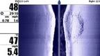
 Re: Humminbird 987c SI Side Imaging GPS Wide Screen Fishing System